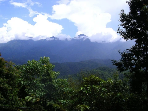
Dolomites

The Dolomites, also known as the Pale Mountains, are a mountain range in northeastern Italy, forming part of the Southern Limestone Alps. They extend from the river Adige in the west to the Piave Valley in the east, and are bordered by the Puster Valley to the north and the Sugana Valley to the south. The range spans the regions of Veneto, Trentino-Alto Adige/Südtirol, and Friuli-Venezia Giulia, covering areas in the provinces of Belluno, Vicenza, Trentino, South Tyrol, Udine, and Pordenone.
- location
- Northeastern Italy
- regions
- Veneto, Trentino-Alto Adige/Südtirol, Friuli-Venezia Giulia
- highest_peak
- Marmolada
- named_after
- Carbonate rock dolomite, named after Déodat Gratet de Dolomieu
- vernacular_name
- Monti Pallidi (Pale Mountains)
Lore & Background
The Dolomites take their name from the carbonate rock dolomite, which was named after the 18th-century French mineralogist Déodat Gratet de Dolomieu, who first described the mineral. The prior local vernacular name 'Monti Pallidi' (Pale Mountains) comes from the overall light color of the dolomite rock, not specifically from sunset reflections. For millennia, hunters and gatherers had advanced into the highest rocky regions and had probably climbed some peaks. Evidence exists that the Jesuit priest Franz von Wulfen from Klagenfurt climbed the Lungkofel and the Dürrenstein in the 1790s. Paul Grohmann later climbed numerous peaks such as the Antelao, Marmolada, Tofana, Monte Cristallo, and the Boè. Michael Innerkofler was one of the climbers of the Tre Cime di Lavaredo. Later very important local mountaineers, known for many first ascents, were Angelo Dibona and Giovanni Piaz.
Reader's Guide
The Dolomites are significant for their geological composition, being named after the mineral dolomite, and for their designation as a UNESCO World Heritage Site. The range is renowned for skiing in winter and mountain climbing, hiking, cycling, BASE jumping, paragliding, and hang gliding in summer and late spring/early autumn. During the First World War, the front line between the Italian and Austro-Hungarian armies ran through the Dolomites, where both sides used mines extensively. Open-air war museums are at Cinque Torri, Monte Piana, and Mount Lagazuoi. Many people visit to climb the vie ferrate, protected paths created during the war. A number of long-distance footpaths called alte vie traverse the Dolomites, numbered 1 to 10. The region is divided into Western and Eastern Dolomites, separated by a line following the Val Badia–Campolongo Pass–Cordevole Valley axis. The Dolomiti Bellunesi National Park and many other regional parks are in the Dolomites, and the Adamello-Brenta UNESCO Global Geopark is also located there.
Did You Know?
- The range is named after the mineral dolomite, which was named after French mineralogist Déodat Gratet de Dolomieu.
- During World War I, the front line between Italian and Austro-Hungarian armies ran through the Dolomites, with both sides using mines extensively.
- The Maratona dles Dolomites is an annual single-day road bicycle race held in the first week of July, with a route that varies yearly and typically includes multiple mountain passes.
The Dolomites as a World War I Fortress
The Dolomites featured prominently in the First World War as a theater where Austro-Hungarian forces leveraged the rugged high terrain to repel Italian offensives. In this alpine conflict, the natural environment proved as lethal as any weapon system—frostbite and avalanches claimed more lives than bullets themselves. The Dolomites thus became a stage where mountain divisions, many of which had not been previously tested in such extreme conditions, faced the brutal reality of high-altitude combat. The uneven ground and the agonizingly slow pace at which troops and materials could be moved up and down steep slopes placed enormous physical demands on every soldier. Reinforcements and medical evacuation in sections where even pack animals could not reach required extraordinary exertion of human energy, making the Dolomites a place where the mountain itself was the primary adversary and the most persistent enemy.
Strategic Geography and the Natural Border
Mountain ranges have long held strategic significance in military affairs, frequently serving as natural borders between nations and as the origin points of vital water sources. The Dolomites, as part of the broader Alpine system, fit squarely into this pattern of geographic importance. Their position made them a natural defensive line, and during the First World War this defensive value was fully exploited by the forces holding the high ground. The terrain's inherent difficulty meant that any attacking force would require a substantially greater number of soldiers to overcome a prepared defensive position than would be necessary on level ground. This tactical asymmetry transformed the Dolomites into a natural fortress, where the defender held an inherent advantage simply by virtue of the landscape, and where the very act of approaching enemy positions demanded a disproportionate investment of manpower and sustained physical effort.
A Lethal Environment Beyond the Battlefield
The Dolomites during wartime presented a catalogue of natural hazards that rivaled or exceeded the dangers posed by opposing soldiers. Lightning strikes, violent gusts of wind, sudden rockfalls, and devastating avalanches all posed constant, unpredictable threats to anyone operating in the high terrain. Snowpacks, ice formations, extreme cold, and glaciers riddled with hidden crevasses added further layers of danger that made the environment itself a silent combatant. In these ways, warfare in the Dolomites bore a close resemblance to cold-weather operations, where survival depended as much on endurance against the elements as on tactical skill. The generally uneven ground further complicated every aspect of military life, from establishing defensive positions to maintaining supply lines, turning the Dolomites into a landscape where nature's indifference to human conflict made every single day a struggle for mere survival.
Tactical Asymmetry in Alpine Combat
Fighting in the Dolomites fundamentally altered the mathematical and logistical calculus of warfare. An attacking force confronting a prepared enemy in such mountainous terrain generally needed a significantly higher ratio of soldiers than the defender to achieve success, a stark contrast to engagements conducted on flat ground. The slow pace of troop movements and material transport up and down steep slopes created enormous energy expenditures for every combatant involved. In the most remote and vertical sections, even pack animals could not reach, meaning that all supplies, reinforcements, and medical evacuations had to be carried by human hands alone. This reality stripped armies of their conventional force multipliers and reduced warfare in the Dolomites to a brutal contest of human endurance against gravity, cold, and the sheer physical demands of moving through terrain that resisted every attempt at efficient military logistics.
Frequently Asked Questions
What are the Dolomites?
The Dolomites are a mountain range in northeastern Italy that forms part of the Southern Limestone Alps. They stretch from the Adige River in the west all the way to the Piave Valley in the east.
Why are the Dolomites nicknamed the 'Pale Mountains'?
The local name Monti Pallidi comes from the strikingly light-colored carbonate rock that dominates the range's peaks. The range itself is named after the mineral dolomite, which honors the French chemist Déodat Gratet de Dolomieu.
Which Italian regions do the Dolomites cover?
The range spans three regions—Veneto, Trentino-Alto Adige/Südtirol, and Friuli-Venezia Giulia—touching six provinces including Belluno, Vicenza, South Tyrol, and Udine.
What is the highest peak in the Dolomites?
Marmolada holds the title of the highest peak in the Dolomites range.
More in Mountain And Alpine Reserves 1-19
Spotted an error? Know more?
This is a living reference — every entry is fact-audited, and reader corrections feed straight into our audit queue. Suggest an edit · See this site's audit record