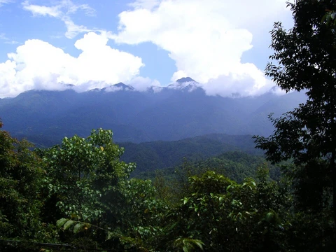
Mount Rainier National Park
Fourth U.S. national park, centered on a glaciated stratovolcano.

The park is known for its glaciers, old-growth forests, subalpine meadows, and as a showcase for early National Park Service rustic architecture.
- location
- Pierce and Lewis counties, Washington, USA
- visitors_2024
- over 1.6 million
Lore & Background
The park was created from the Pacific Forest Reserve after a five-year effort led by John Muir, the Sierra Club, the National Geographic Society, and commercial interests. Congress approved only after assurances that the land was unsuitable for farming or mining and required no federal appropriations for management. The park's purpose, as stated in its foundation document, is to protect Mount Rainier's natural and cultural resources and provide wilderness experiences. Ethnographic studies suggest the park was used for hunting, gathering, and spirit quests, with no evidence of permanent habitation. The mountain is called 'Tacoma' in Lushootseed. The Carbon River Road remained closed to vehicles.
Reader's Guide
Mount Rainier National Park is significant as the first national park created from a national forest, marking a shift in conservation philosophy from utilitarian forest reserves to preservationist national parks. The park's glaciers, including Carbon Glacier (largest by volume in the contiguous U.S.) and Emmons Glacier (largest by area), provide critical research opportunities in volcanism and glaciology.
Did You Know?
- Mount Rainier National Park was the first national park created from a national forest.
- Carbon Glacier is the largest glacier by volume in the contiguous United States.
- The mountain is called 'Tacoma' in the Lushootseed language.
Geographic Dominance & Glacial Identity
On clear days it dominates the southeastern horizon across the Seattle-Tacoma metro area—locals often call it simply "the Mountain"—and on days of extraordinary clarity, it can be glimpsed from Corvallis, Oregon, and the North Shore Mountains in British Columbia. The mountain's ice is extraordinary. Twenty-six major glaciers and 36 square miles of permanent snowfields make it the most heavily glaciated peak in the lower 48 states. The summit is crowned by two volcanic craters, each exceeding 1,000 feet in diameter, where geothermal heat keeps patches of the rims bare. Inside the ice-filled craters, the world's largest volcanic glacier cave network stretches nearly 2 miles. The Carbon, Cowlitz, Nisqually, Puyallup, and North Mowich Rivers all originate on the mountain's glaciers.
Volcanic Hazard & the Lahar Threat
Mount Rainier is an active stratovolcano, and its combination of eruptive potential and proximity to a major urban area places it among the most dangerous volcanoes on Earth. It holds a spot on the Decade Volcano list, a designation reserved for peaks with a high probability of erupting in the near future. The mountain's enormous glacial ice creates a particularly severe secondary hazard: lahars. These catastrophic debris flows of ice, rock, and mud could sweep down the Puyallup River valley and other drainage basins, including those of the Carbon, White, Nisqually, and Cowlitz rivers above Riffe Lake. For the communities of the Puget Sound region, the mountain that graces their skyline on clear afternoons also represents one of the most consequential natural threats to their safety. The active magma system beneath the summit, combined with vast ice volumes and dense downstream populations, creates a hazard profile that very few other volcanoes in the world can match.
Indigenous Names & the Naming Rivalry
Long before European explorers arrived, Indigenous peoples who had lived near the mountain for millennia gave it names in their own languages. Lushootseed speakers used xʷaq̓ʷ, meaning "sky wiper" or "one who touches the sky," and təqʷubəʔ, meaning "snow-covered mountain." Cowlitz speakers called it təx̣ʷúma or təqʷúmen, while Sahaptin speakers borrowed the Cowlitz form as Tax̱úma. The word təqʷubəʔ was anglicized into various spellings, including "Tacoma" and "Tacobet."
When George Vancouver named the peak after his friend Rear Admiral Peter Rainier, a naming rivalry was born.
Climbing, Subsidiary Peaks & a Shifting Summit
The human cost of climbing is significant. Adding to the complexity, Mount Rainier was one of five historical icecap summits in the lower 48 states, meaning its recorded elevation shifts as glaciers melt.
More in Mountain And Alpine Reserves 1-19
Spotted an error? Know more?
This is a living reference — every entry is fact-audited, and reader corrections feed straight into our audit queue. Suggest an edit · See this site's audit record