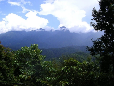
Hoh Xil
Isolated plateau region, UNESCO World Heritage Site since 2017.

On July 7, 2017, the Hoh Xil in Qinghai was listed among the UNESCO World Heritage Sites as 'the largest and highest plateau in the world'.
- area
- 83,000 square kilometres
- location
- Border areas of Tibet Autonomous Region, Qinghai Province, and Xinjiang Uyghur A
- unesco_world_heritage_site
- July 7, 2017
- known_for
- Largest and highest plateau in the world; habitat for endangered Tibetan antelop
Lore & Background
The region is volcanic, part of the Northern Tibet volcanic field with late-Cenozoic volcanoes such as Bamaoqiongzong, Yongbohu, and Qiangbaqian.
Reader's Guide
Hoh Xil's significance lies in its status as the largest and highest plateau in the world, recognized as a UNESCO World Heritage Site in 2017. Zhuonai Lake is a known gathering place for Tibetan antelope. The region's volcanic geology and endorheic lake district add to its scientific interest.
Did You Know?
- The Hoh Xil region in western Qinghai province was listed as a UNESCO World Heritage Site on July 7, 2017.
- The endangered Koslov's pika was first identified in 1884 from just two specimens, then 'lost' for over 100 years before being rediscovered in the Kunlun Mountains.
- The ecoregion's climate is classified as Tundra (Köppen ET), with no month averaging above 10 °C and precipitation under 50 mm/year over much of the area.
- Chang Tang Nature Reserve, which protects part of this ecoregion, is the world's third largest nature preserve.
- A 2017 estimate found that approximately 239,046 square kilometers of the ecoregion are within protected areas.
A Landscape Carved by Altitude and Aridity
The North Tibetan Plateau-Kunlun Mountains alpine desert ecoregion stretches across a vast, largely treeless corridor along the northern rim of the Tibet Plateau. Its western boundary touches the eastern slopes of the Pamir Mountains, while the northern edge traces the Kunlun range and the southern reaches dip toward the Karakoram. Moving eastward, the terrain hugs the southern lip of the arid Tarim Basin, threading a long, narrow band of high-altitude wilderness. Elevations climb above five thousand meters across most of the territory, with the highest ground concentrated in the northwest. Soils tend toward salt-encrusted barrenness, and permafrost blankets a significant portion of the ground beneath the surface. The overall character is one of extreme remoteness, cold, and dryness. Habitats range from alpine meadows and open steppe to true desert and patches of low cushion-plant communities, all shaped by a landscape where trees are virtually absent and the environment offers little shelter from the elements.
A Tundra Climate of Wind and Scarcity
The ecoregion falls squarely within the tundra climate category under the Köppen system, designated ET. This means that while at least one month each year sees average temperatures rise above the freezing mark, no single month ever averages above ten degrees Celsius. The result is a world without true summer warmth. Rainfall and snowfall combined are extraordinarily scarce, with much of the territory receiving less than fifty millimeters of precipitation over an entire year. What moisture does arrive is quickly lost to evaporation or locked away in permafrost. Perhaps as defining as the cold and the dryness are the winds, which blow with notable strength and persistence across the exposed high-altitude terrain. Together, these climatic forces create an environment where liquid water is a fleeting resource, temperatures hover near or below freezing for most of the year, and the relentless wind strips away any accumulated snow or topsoil. It is a climate that permits only the most specialized organisms to persist.
Life in the Thin Margin
Only organisms with extraordinary adaptations can endure this landscape, and the result is a biota of remarkable scarcity. Trees are nearly absent, with just small, isolated stands of Asian spruce and juniper shrubs clinging to low, north-facing slopes where they can intercept whatever moisture or snowmelt the terrain offers. Along river channels, a salt-tolerant variety of tamarisk survives by keeping most of its woody structure below the soil surface. On slopes that dip below roughly five thousand three hundred meters, a sparse high-cold steppe assemblage takes hold, featuring sedges, purple feathergrass, and a falcate form of locoweed. Among the animals, the most remarkable resident is the endangered Koslov's pika, a small burrowing lagomorph found nowhere else on Earth. It lives in tight-knit family groups. The species was first described in 1884 from just two specimens, then vanished from scientific records for more than a century before isolated populations were rediscovered in the Kunlun Mountains.
Protection at Scale
Despite its extreme inaccessibility, the ecoregion benefits from a substantial conservation framework. A 2017 assessment estimated that approximately 239,046 square kilometers of the territory fall within formally protected areas. Among these is the Chang Tang Nature Reserve, which holds the distinction of being the third-largest nature preserve on the planet. The Sanjiangyuan region and the Altun Shan National Nature Reserve also contribute significant protected tracts, the latter encompassing much of the ecoregion's eastern extension. Most notably, the Hoh Xil region in western Qinghai province received UNESCO World Heritage Site designation, recognizing its outstanding universal value as a high-altitude wilderness. Together, these designations represent a remarkable commitment to preserving one of the most remote and ecologically unique landscapes on Earth, ensuring that its fragile alpine desert ecosystems, specialized flora, and endemic wildlife like the Koslov's pika retain a measure of security against the pressures of a changing world.
Frequently Asked Questions
What is Hoh Xil and where is it located?
Hoh Xil is a remote highland region in the northeastern part of the Qinghai-Tibet Plateau, straddling the borders of Tibet, Qinghai, and Xinjiang in China. It goes by other names as well, including Kekexili (Mongolian for 'Blue Ridge') and Aqênganggyai, meaning 'Lord of Ten Thousand Mountains.'
How big and elevated is the Hoh Xil plateau?
The region covers roughly 83,000 square kilometres at a mean altitude of about 4,800 metres above sea level, making it the most extensive and highest plateau on Earth. Its earlier national nature reserve designation (1995) encompassed 45,000 square kilometres at an average elevation of 4,600 metres.
When was Hoh Xil inscribed as a UNESCO World Heritage Site?
On July 7, 2017, UNESCO added Hoh Xil to its World Heritage list, citing its status as the planet's largest and highest plateau. It had already held national nature reserve status since 1995, but the 2017 inscription gave it international recognition and protection.
What endangered wildlife does Hoh Xil protect?
The plateau is a vital refuge for the Tibetan antelope, a species heavily targeted by poachers and vulnerable to habitat disruption. Its vast, largely undisturbed highland terrain provides essential grazing and calving grounds that few other regions can offer.
Why is Hoh Xil significant to alpine and plateau ecology?
As the highest and most extensive plateau on the planet, it plays a critical role in regional hydrology, climate buffering, and the survival of high-altitude species. Its extreme isolation and elevation create an ecosystem with no true equivalent anywhere else on Earth.
More in Mountain And Alpine Reserves 1-19
Spotted an error? Know more?
This is a living reference — every entry is fact-audited, and reader corrections feed straight into our audit queue. Suggest an edit · See this site's audit record